Tsunami Awareness
In general, Palo Alto's position in the Southern San Francisco Bay and not a direct coastal community results in a very low tsunami risk, with the primary hazard to our Baylands area. Those who live and work outside of the Baylands should not immediately attempt to evacuate to higher ground, but pay attention to the information that is available and make an informed decision. Nevertheless, preparedness remains key, and comprehending tsunami conditions is essential for making sound safety decisions. This page will provide you with helpful information to better understand the tsunami hazard and risks to our area.
Sign up for emergency alerts and stay connected
What is a tsunami?
A tsunami is one of nature’s most powerful and destructive forces. It’s a series (more than one) of extremely long waves caused by a large and sudden displacement of the ocean (after an earthquake, for example). A tsunami radiates outward in all directions from its source and can move across entire oceans in less than a day.
Where do tsunamis occur?
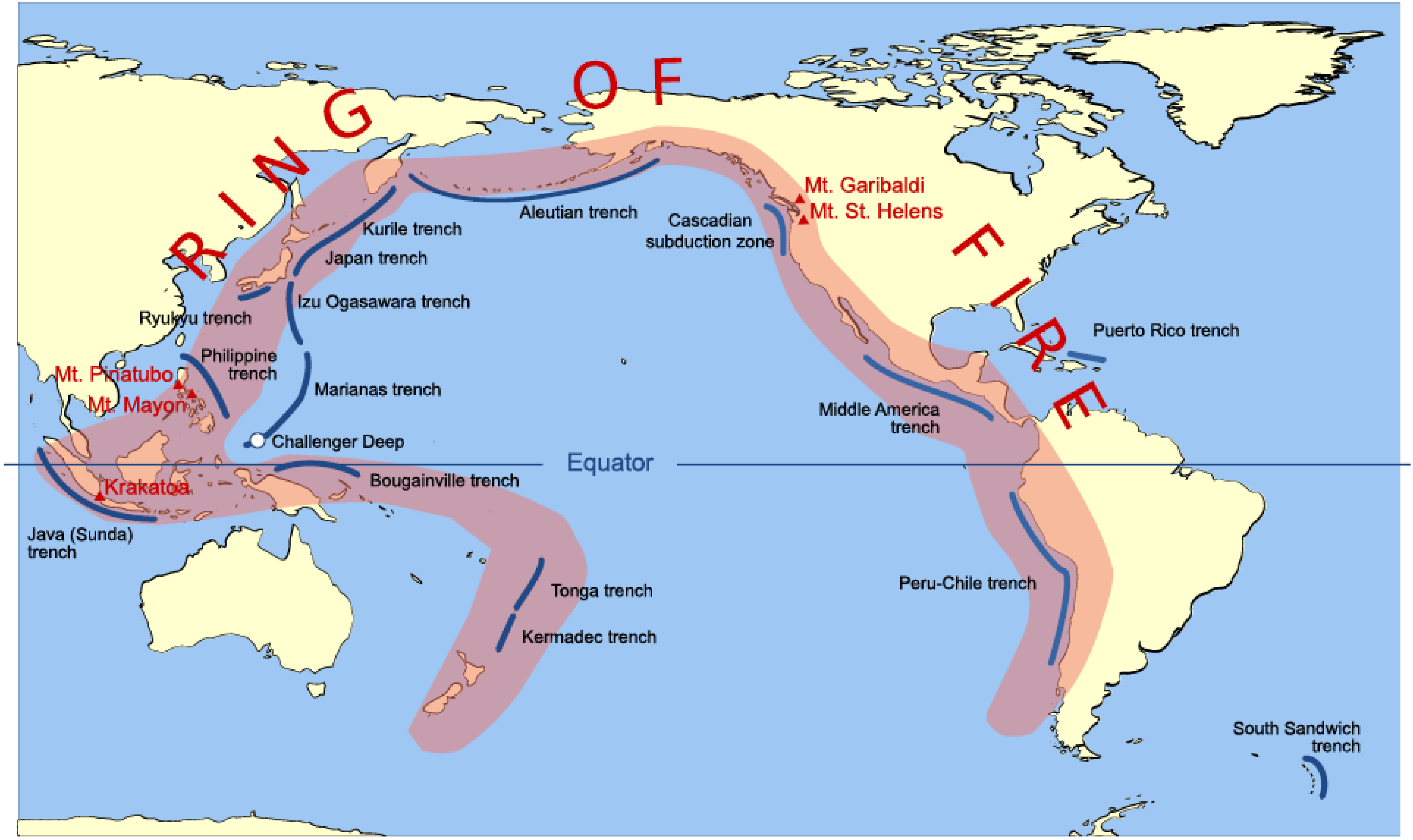
Tsunamis can be generated in any large body of water. They can strike any coastal area all around the world. Certain coastal areas are particularly vulnerable to tsunami include beaches, bays, lagoons, harbors, and coastal rivers. California can be impacted by both local and distant tsunamis as a result of our location in the Ring of Fire.
What is our tsunami hazard and associated risk?
The California Geological Survey prepared this Tsunami Hazard Area (shaded yellow on map) to assist cities and counties identify their tsunami hazard for tsunami response planning. The hazard area represents the maximum considered tsunami runup from several extreme, infrequent, and realistic tsunami sources. These data are intended for local jurisdictional, coastal emergency planning uses only.
Using this map and zooming into the Palo Alto area, we see that the threat is very low to Palo Alto. To minimize risks, stay away from the Baylands area whenever a tsunami warning is issued.
What are Tsunami Alerts?
The National Tsunami Warning Center will issue a tsunami alert when there's a potential threat of a tsunami impacting coastal areas. There are different types of alerts, each with increasing levels of urgency and associated actions.
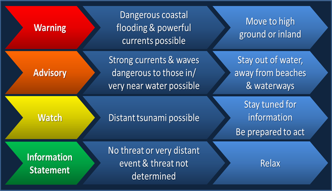
- Tsunami Warning: Take Action—Danger! A tsunami that may cause widespread flooding is expected or occurring. Dangerous coastal flooding and powerful currents are possible and may continue for several hours or days after initial arrival.
Follow instructions from local officials. Evacuation may be recommended. Move to high ground or inland (away from the water).
- Tsunami Advisory: Take Action—A tsunami with potential for strong currents or waves dangerous to those in or very near the water is expected or occurring. There may be flooding of beach and harbor areas. Stay out of the water and away from beaches and waterways. Follow instructions from local officials.
- Tsunami Watch: Be Prepared—A distant earthquake has occurred. A tsunami is possible.
Stay tuned for more information. Be prepared to take action if necessary.
- Tsunami Information Statement: Relax—An earthquake has occurred, but there is no threat or it was very far away and the threat has not been determined. In most cases, there is no threat of a destructive tsunami.
Note: Tsunami warnings, advisories, and watches may be updated or cancelled as information becomes available. Advisories, watches, and information statements may be upgraded if the threat is determined to be greater than originally determined.
The National Tsunami Warning Center will also issue Bulletins to describe the event that may generate a tsunami, the areas that may be impacted, the time of arrival of the waves, the amplitude of the wave, and the duration of the threat. These bulletins are available at U.S. Tsunami Warning Centers.
How are Alerts Issued?
Tsunami alerts are issued in several ways.
- When the National Tsunami Warning Center generates a bulletin, news organizations report at the national and local level through their outlets. In many cases this will be the first notice that people will see.
- The City of Palo Alto will provide notifications based on the situation in a variety of ways - we encourage you to keep in touch and to Stay Informed.
- If Santa Clara County is in the Warning area, the National Oceanic and Atmospheric Administration (NOAA) will issue a Wireless Emergency Alert - your mobile phone will automatically get this alert. WEA has a limitation of 360 characters, so only essential information can be provided.
- The WEA will have specific details that are important to understand in advance:
- English 360 Character Message: The National Weather Service has issued a TSUNAMI WARNING. A series of powerful waves and strong currents may impact coasts near you. You are in danger. Get away from coastal waters. Move to high ground or inland now. Keep away from the coast until local officials say it is safe to return.
- Spanish 360 Character Message: El Servicio Nacional de Meteorologia ha emitido un AVISO DE TSUNAMI. Olas y corrientes fuertes pueden afectar costas cercanas. Su vida esta en peligro. Alejarse de aguas costeras. Moverse ahora a un lugar alto o tierra adentro. Mantenerse alejado hasta que las autoridades locales indiquen que es seguro regresar.
Remember, the majority of Palo Alto is outside the hazard area, so this message will only apply to those in the Baylands areas, but pay attention to trusted local information sources.
Please only call 9-1-1 in an emergency. Sign up for emergency alerts.