Palo Alto Horizontal Levee Pilot Project Completion Celebration
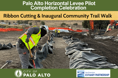
Palo Alto and regional leaders, community members, and community groups are invited to the Palo Alto Horizontal Levee Pilot Project Completion Celebration.
Join the Palo Alto Mayor, Palo Alto City Officials and Regional partners including San Francisco Estuary Partnership, Association of Bay Area Governments, California State Coastal Conservancy, US Environmental Protection Agency and research and community educational partners including United States Geological Survey (USGS), California State University Channel Islands, and University of California Davis and community partners Save the Bay, Nuestra Casa, Association for Ramaytush Ohlone, and Environmental Volunteers to mark the completion of the Palo Alto Horizontal Levee Pilot Project.
The event will showcase the innovative project and partners advancing new approaches to protecting our shoreline communities against sea level rise, noting a speaker’s program, ribbon-cutting and inaugural community trail walk, officially recognizing the relocated and widened trail connection, connecting hikers and bikers to the Baylands Nature Preserve trail and San Francisco Bay trail systems.
Event Details: Thursday, September 10, 2026, 11:00 a.m.- 12 p.m. at the Palo Alto Horizontal Levee Pilot project located at 2470 Embarcadero Road, Palo Alto, CA.
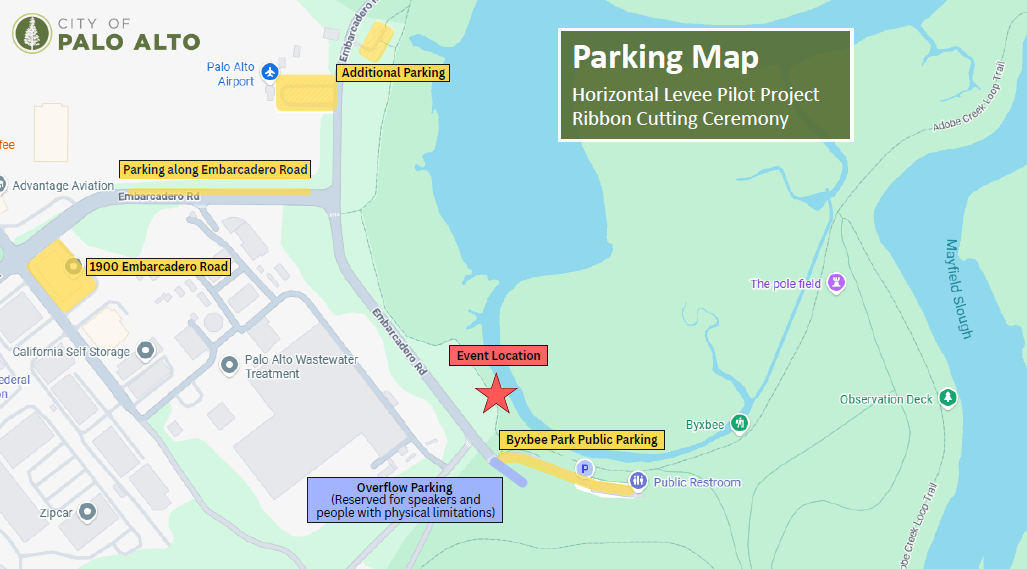
Parking: Attendees are encouraged to carpool, walk or bike to the event. Bike parking will be available near the project site. Vehicle parking is limited at the project location; attendees are encouraged to park for free at 1900 Embarcadero Rd. It is a short five minute and two block walk to the project location.
Join us for a short speaker’s program, ribbon cutting ceremony, and community trail walk to officially recognize the opening of the relocated and widened trail connecting hikers and bikers to the Baylands Nature Preserve and Byxbee Park trails and San Francisco Bay Trail system. Refreshments and snacks will be provided.
Project Description: Using nature to shape and protect the environment, Palo Alto’s project is the first of its kind in the Bay Area leading sea level rise planning. A nature-based approach providing protection against sea level rise and enhancing habitat in the San Francisco Bay, the project is built on the San Francisco Bay shoreline using effluent from the Regional Water Quality Control Plant to irrigate native plantings and informing future “living levee” designs all around the Bay Area. In collaboration with the San Francisco Estuary Partnership, the pilot project is located on a 500-foot-long section of coastline on Harbor Marsh in the Palo Alto Baylands. It restored various marsh habitat types, such as seasonal and perennial wet meadows, freshwater marsh, riparian scrub and upland habitat. Scientific researchers at United States Geological Survey (USGS), California State University Channel Islands, and University of California Davis will study the levee to understand how it changes over time, and what habitat benefits it may offer compared to a traditional levee.
This project received funding from the California Department of Water Resources, City of Palo Alto, the US Environmental Protection Agency, and the California State Coastal Conservancy.
When
-
Thursday, September 10, 2026 | 11:00 AM
- 12:00 PM
Location
2470 Embarcadero Road, Palo Alto, CA, View Map
37.4515188,-122.111935
2470 Embarcadero Road ,
Palo Alto, CA
2470 Embarcadero Road ,
Palo Alto, CA
Palo Alto Horizontal Levee Pilot Project Completion Celebration