Storm Update Archives
FEBRUARY 24, 2026 UPDATE: The National Weather Service forecast notes minor rain expected overnight into Wednesday. No risk of flooding. There may be possible water ponding in roadways.
FEBRUARY 18, 2026 UPDATE: E Bayshore (northbound lane) at San Antonio was reopened at 6 a.m. this morning.
FEBRUARY 17, 2026 UPDATE: Moderate rain is expected in Palo Alto through the next week with minimal risk. The lowest temperature is expected to be about 36°F on Thursday night. While widespread flooding is not anticipated, expect wet roads and occasional water ponding in low spots, which can create slick driving conditions and travel impacts.
E Bayshore Rd (northbound lane) is closed at San Antonio Rd due to flooding at E Bayshore Rd and Corporation Way. The lane will remain closed until Wednesday morning. Please avoid the area if possible and use alternate routes. Drive with caution and report any issues through
In addition, due to an Inclement Weather Alert from the County for cold weather, the City’s OWL (Overnight Warming Location) is open from nightly from 7 p.m. to 7 a.m., Tuesday, February 17 through Sunday, February 22 at Bryant Street Community Center (429 Bryant Street, Sycamore Room).
JANUARY 8, 2026 UPDATE: The County has issued an Inclement Weather Alert for the cold weather this weekend. Palo Alto’s Overnight Warming Location at the Downtown Library, El Camino Room, will be open from 7 p.m. to 7 a.m. on Thursday, January 8, and Friday, January 9. Hazardous conditions are forecasted at all Pacific Coast beaches through Friday and again early next week. Residents should exercise caution, especially in coastal areas.

JANUARY 2, 2026 UPDATE: The National Weather Service updated its forecast noting substantial coastal flooding from King Tides and storm surge through Sunday, January 4. Embarcadero Road from the Airport Entrance to the Sail Station closure in effect today and Saturday, including the Duck Pond, several trails. Other items to note: Wind Advisory in effect today through Saturday with gusts up to 50 mph expected, thunderstorms possible through Sunday, and moderate to heavy rain through Monday with a chance of flash flooding. Low to no flood risk outside of coastal impacts anticipated at this time, however, staff are monitoring storm related community impacts and will share updates should conditions change. Storm community impacts could include water ponding on roads, tree limbs and debris in roadways causing travel delays. Report any issues through Palo Alto 311. The Overnight Warming Location at the Downtown Library, El Camino Room continues to be open evenings from 7 p.m. to 7 a.m. through Sunday morning, January 4, 2026.
JANUARY 1, 2026 UPDATE: The National Weather Service has issued a Wind Advisory for Friday and Saturday. Moderate to heavy rain will continue into next week. The creek monitor was offline overnight and has since been repaired and is back online. Several roads and trails of the Baylands Nature Preserve are closed this morning due to minor flooding from the storm surge and King Tides including Embarcadero Road from the Airport to the Sail Station, Marsh Front Trail and SF Creek Trail from SF Creek outlet to Nature Center Parking Lot. As a reminder, due to inclement weather and hazards, Palo Alto Open Space Preserves may close or partially restrict access without notification.
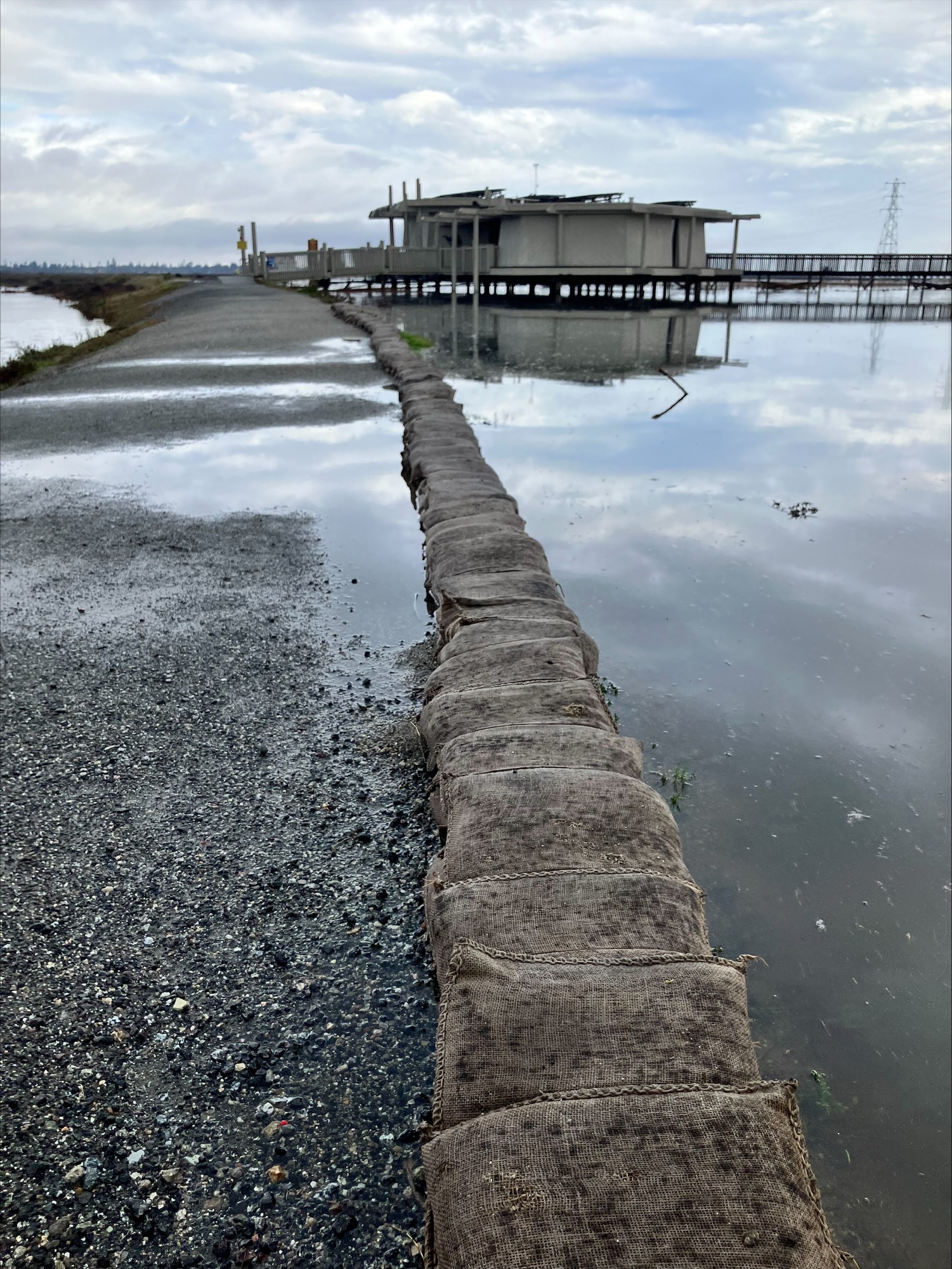
DECEMBER 31, 2025 UPDATE: The National Weather Service expects cold temperatures to continue, with moderate to heavy rain forecasted through Monday with coastal flood advisory in effect due to King Tides (occurring from January 1- January 3) and storm surge. High wind gusts forecasted in higher elevations west of 280 forecasted on Friday and Saturday. Low to no flood risk outside of coastal impacts anticipated at this time, however, staff are monitoring storm related community impacts and will share updates should conditions change. The Lucy Evans Baylands Nature Preserve Interpretive Center is closed through January 4. Baylands Nature Preserve is open at this time, though possible closures due to King Tides are possible with signage posted should closures occur. Storm community impacts could include water ponding on roads, tree limbs and debris on roadways causing travel delays. Secure outdoor furniture, clear storm drains, and check on neighbors. Drive with caution and report any issues through Palo Alto 311. The Overnight Warming Location at the Downtown Library, El Camino Room, will be open evenings from 7 p.m. to 7 a.m. through Sunday morning, January 4, 2026.
DECEMBER 30 UPDATE: The National Weather Service expects cold overnight temperatures today and tonight. Moderate to heavy rain is forecasted today through Monday with possible coastal flooding due to King Tides occurring Wednesday to Sunday. Impacts could include water pooling on roads, and possible travel delays. Secure outdoor furniture, clear storm drains, and check on neighbors. Drive with caution and report any issues through Palo Alto 311.
The Overnight Warming Location at the Downtown Library, El Camino Room, will be open evenings from 7 p.m. to 7 a.m. through Sunday morning, January 4, 2026.
DECEMBER 24 UPDATE: The National Weather Service extended their severe weather forecast noting possible flash flooding, high winds, and thunderstorms. A Flood Watch is in effect due to heavy rain with periods of moderate to heavy rain fall expected for the Bay Area, including Palo Alto, through Friday, December 26. A High Wind Watch is in effect through Wednesday morning with 20-30 mph winds expected and wind gusts up to 60 mph possible to impact coastal areas and higher elevations west of 280. Storm impacts could include water ponding in local roadways, down tree limbs/debris, and possible power outages, hail and thunderstorms. Coastal hazards continue with high winds and severe waves. While flood risk is low at this time, staff is monitoring conditions and will share another update mid-week should conditions change significantly. Sign-up for emergency alerts, secure outdoor furniture and storage, clear storm drains and check in on neighbors. If your property is prone to flooding, consider picking up sandbags at Palo Alto locations as a precaution. Drive safely and report any neighborhood impacts through Palo Alto 311.
In addition, the County has issued an Inclement Weather Alert due to heavy rain and wind in the forecast, and Palo Alto’s Overnight Warming Location at the Downtown Library, El Camino Room will be open evenings 7 p.m.- 7 a.m. on Monday, December 22 through Monday, December 29.
DECEMBER 22, 2025 UPDATE: The National Weather Service updated their forecast for the series of storms to hit the Bay Area this week noting possible flash flooding, high winds, and thunderstorms. A Flood Watch is in effect due to heavy rain with periods of moderate to heavy rain fall expected for the Bay Area, including Palo Alto, Tuesday December 23 through Friday, December 26. A High Wind Watch is in effect Tuesday evening through Wednesday morning with 20-30 mph winds expected and wind gusts up to 60 mph possible to impact coastal areas and higher elevations west of 280. Storm impacts could include water ponding in local roadways, down tree limbs/debris, and possible power outages. While flood risk is low at this time, staff is monitoring conditions and will share another update mid-week should conditions change significantly. Sign-up for emergency alerts, secure outdoor furniture and storage, clear storm drains and check in on neighbors. If your property is prone to flooding, consider picking up sandbags at Palo Alto locations as a precaution. Drive safely and report any neighborhood impacts through Palo Alto 311.
In addition, the County has issued an Inclement Weather Alert due to heavy rain and wind in the forecast, and Palo Alto’s Overnight Warming Location at the Downtown Library, El Camino Room will be open evenings 7 p.m.- 7 a.m. on Monday, December 22 through Thursday, December 25.
DECEMBER 18, 2025: The National Weather Service is forecasting a series of atmospheric river storms with high levels of uncertainty to hit the Bay Area and North Bay noting heavy rain, flash flooding and high wind gusts of up to 45 mph in higher elevations that could lead to community impacts of possible water ponding, tree limbs/debris in roadways and power outages. Light showers tonight and heavier rain with low flood risk into Friday. The second storm system forecasts heavier rain and creek flows in Palo Alto, with wind gusts of 30-45 mph expected starting on Saturday evening through Wednesday. Significant uncertainty exists in the forecast noting possible flash flooding and heavier rain in the second and third rain systems. While flood risk is low at this time, staff is monitoring conditions and will share another update on Monday or earlier should conditions change significantly. Sign-up for emergency alerts, secure outdoor furniture and storage, clear storm drains, and check in on neighbors. If your property is prone to flooding, consider picking up sandbags at Palo Alto locations as a precaution.

NOVEMBER 12, 2025: The National Weather Service updated their forecast for the first atmospheric river storm of the season noting possibly 1-2” of rain with Thursday bringing the most rainfall, and a 15% chance of excessive rainfall that could cause flash flood conditions. A Wind Advisory is in effect 10 p.m. tonight through 10 a.m. Thursday, November 13 with possible wind gusts of 35-40 mph, and greater wind impacts at higher elevations. Rain stays in the forecast over the next 10-day period. Community impacts due to rain and wind include rain ponding and debris in our roadways, downed tree limbs, and possible power outages.

NOVEMBER 11, 2025: Per the National Weather Service, the first atmospheric river of the season is arriving mid-week with rainfall of 1”-2” expected between Wednesday through Friday and strong wind gusts up to 30 mph Wednesday evening to Thursday morning. Stronger wind gusts forecasted along coastal areas and higher elevations. There is a small chance of thunderstorms with lightning. Community impacts due to rain and wind include rain ponding and debris in our roadways, downed tree limbs, and possible power outages.
NOVEMBER 3, 2025: The National Weather Service is forecasting another early season storm to impact Palo Alto on Tuesday through Wednesday. Possible community impacts from rain and wind include ponding and debris in local roadways, downed trees and power outages. Heavy winds up to 40-50 mph are possible in the higher elevations west of 280 and 25-35 mph in lower elevations.
OCTOBER 12, 2025 UPDATE: The National Weather Service is forecasting a notable early season rainstorm Monday and Tuesday with substantial rain; 1-2 inches in the lower elevations and up to 3 inches in higher elevations. Thunderstorms are also possible increasing rain amounts and possible high wind and small hail. While there is no flood risk at this time, community impacts may include water ponding in roadways, fallen debris and possible power outages due to high winds. Storm preparedness reminders: sign-up for emergency alerts, clear storm drains, monitor creek levels, and report community concerns.
